Ryukyu
Islands
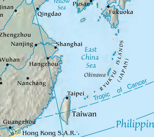
The Ryukyu Islands
is a chain of islands in the western Pacific, on the eastern limit of the East
China Sea and to the southwest of the island
of Kyūshū in Japan. From
about 1829 until the mid 20th century, they were alternately called Luchu, Loochoo, or Lewchew,
akin to the Mandarin pronunciation Liuqiu.
They stretch southwest from the Japanese island
of Kyūshū to within
120 kilometers of the island
of Taiwan. The largest of
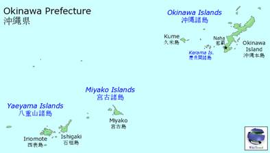
the islands is Okinawa
Island. The islands are
administratively divided into the Satsunan
Islands to the north, belonging to Kagoshima Prefecture,
and Ryūkyū Shotō to the south, belonging to Okinawa Prefecture, Japan.
The Ryukyu
Kingdom was once an independent
kingdom occupying the island chain, from Yonaguni Island
in the southwest to Amami Ōshima in the north. In 1372, it became a
tributary state of the Ming Dynasty of China. In 1609, Shimazu Tadatsune, Lord
of Satsuma, invaded the Ryūkyū
Kingdom. After that, the
kings of the Ryukyus paid tribute to the Japanese shogun as well as the Chinese
emperor. In 1879, the Japanese Meiji government announced the annexation of the
Ryukyus. China,
weakened from internal corruption and colonial occupation, refused the request of
the Ryukyuan king to send military protection.
At the end of WWII, The US was
granted control over Ryukyu Islands south of
29°N latitude amongst other Pacific islands. US
military control over Okinawa began in 1945
with establishment of the Okinawa Advisory Council. This organization
eventually became the government of the Ryukyu Islands
which existed from 1952 to 1972. Sovereignty was given to Japan in 1972.